Weather forecast changes
Published 5:33 pm Thursday, January 27, 2022
|
Getting your Trinity Audio player ready...
|
Even though all of the Roanoke-Chowan area counties are under a Winter Storm Watch, it appears that the heavy bands of snow in the forecast for Friday night into Saturday will stay to our north and east.
As of their latest weather advisory at 3:45 pm today (Thursday), the National Weather Office in Wakefield, VA is predicting 1-to-2 inches of snow in the R-C area. That could lead to some slippery roads, so local motorists are advised to take caution.
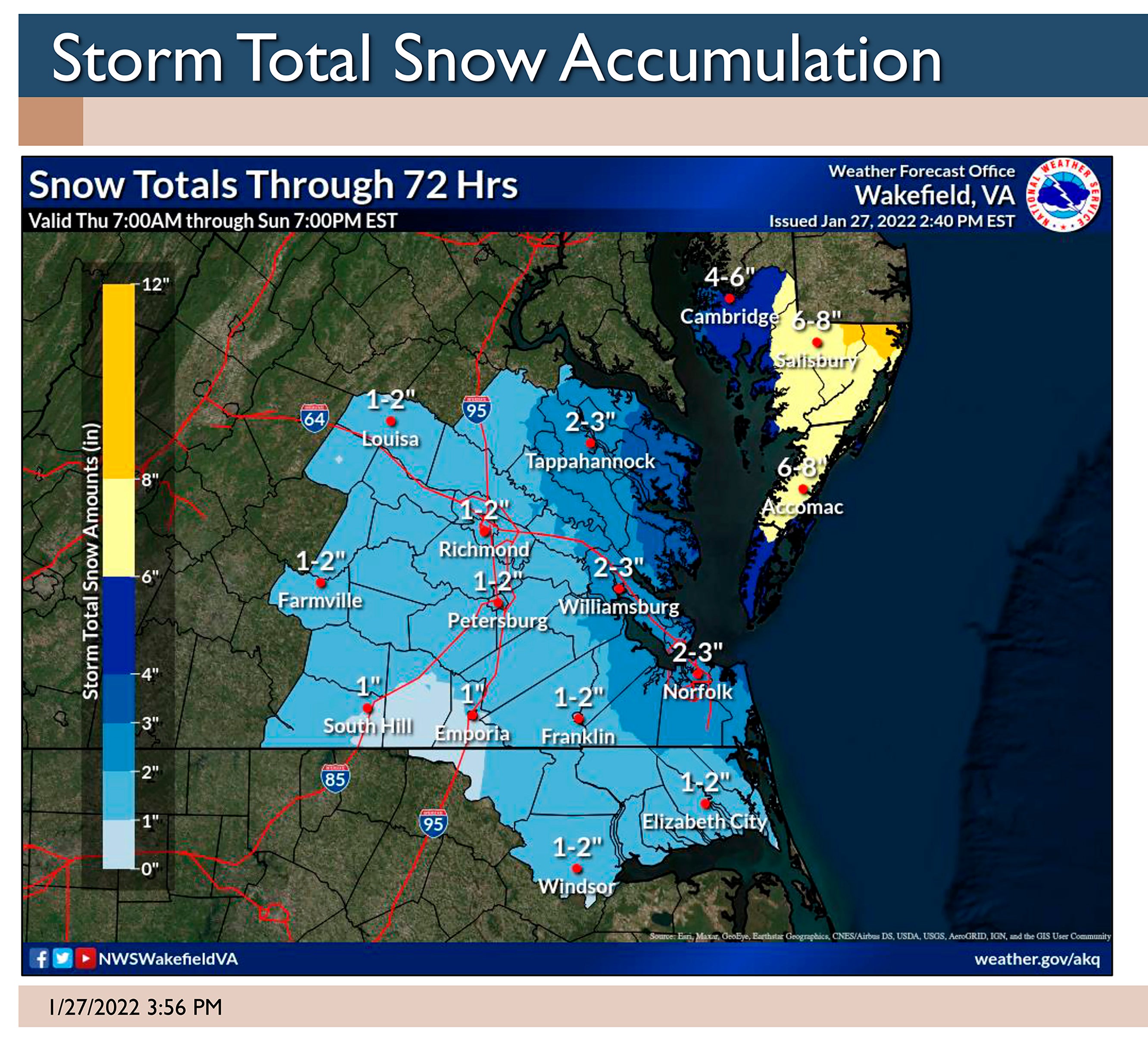
NWS-Wakefield officials said that a coastal storm will bring accumulating snow to the area, the heaviest likely for the Virginia and Maryland Eastern Shore where 6-to-10 inches are expected.
They did not completely rule out a higher amount of snow in the R-C area, but said there’s only a 1-in-10 chance of six inches or more.
Throughout the region, precipitation starts off as light rain Friday afternoon before transitioning to all snow late Friday evening and into Friday night where the low will be 29 degrees.
Locally on Saturday, expect a high temperature of 33 degrees. There’s a chance of light snow with accumulation of less than one inch possible. Skies will begin the clear later in the day, but it will be breezy with a north wind at 15 to 20 mph, with gusts as high as 30 mph.
Clearing skies will give way to frigid temperatures on Saturday night with a low of 10 degrees.
Expect sunny skies on Sunday and Monday. Sunday will still be cold with a high of 35. The temps will warm into the mid to upper 40’s on Monday.
About Cal Bryant
Cal Bryant, a 40-year veteran of the newspaper industry, serves as the Editor at Roanoke-Chowan Publications, publishers of the Roanoke-Chowan News-Herald, Gates County Index, and Front Porch Living magazine.
 More by Cal